Search and Rescue GPS's and Maps - "so that others may live"
![]()
Search and Rescue GPS's and Maps - "so that others may live"
1 - (973)-694-7425 (New
Jersey) 9AM - 5PM (Mon-Fri)
Support@jungleghost.com
Jungle Ghost Magellan Explorist GC / 310 / 510 / 610 /710 Sales and Technical Support Headquarters
Our organization has gained and earned recognition as experts for the Magellan Triton GPS Series... and now we have been engaged to support the New eXplorist GC/310/510/610/710 World of GPS'r - "A New Adventure for ALL!! ™"
PRESENTLY AVAILABLE!!!
|
![]()
| FOR
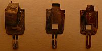
EXPLORIST REPLACEMENT DISPLAY SCREENS
FOR
EXPLORIST 510 - 610 - 710 - PRO 10 REPLACEMENT DISPLAY
SCREENS
Want to see the internals of the New Explorist GPS. Click Here to see the NEW LCD/NEW CAMERA IN A 510 Unit |
Have You Joined the ExploristForum.com? If not, please do.
The Title of the Forum is "The New Explorist X10's Uncovered". Here
you will find over 1550
members, who are also Triton GPS users, who can assist you with topics ranging from the
best X10 to purchase, problems "Uncovered" with the X10 units, glitches and bugs
and how to fix them and more. |

My organization has gained and earned recognition as experts for the Magellan Triton GPS Series... and now we have been engaged to support the new EXPLORIST GC 310 510 610 and 710 GPS Series.
We will start our support of the new Explorists by offering our special Detailed TOPO City and Summit Maps for North America, Western Europe, Australia and New Zealand. Additionally we will offer the complete Fishing Hot Spot Maps, ATV Trails for the Lower 48 States, Snowmobile Maps for USA and Canada and Hunting Maps.Interested in Geocaching These Links
and Information That Can Assist You
Also Included are the New Magellan Communicator Release
These work GREAT on our Special New Magellan Explorist GC
| WARNING: WE CAUTION YOU NOT TO USE THE MAGELLAN COMMUNICATOR TO LOAD GEOCACHES. IF YOU WISH TO DO THIS YOU MUST USE AN HTML (XML) STRIPPER TO REMOVE DANGEOUS CODES WHICH WILL CAUSE YOUR TRITON UNIT TO REPORT AN "INTERNAL ERROR". CLICK HERE INSTRUCTIONS ON AVOIDING THIS PROBLEM. |
| The Best Way to Load Geocaches on Explorists and Tritons .. pdf file that will be transferred to your computer. |
| Magellan
Communicator Version 1.03 .. Released 4/6/10 With this product you can create a
direct connection between your web browser and your Magellan GPS receiver connected to PC
via USB cable. Enables data transfer from Geocaching.com in GPX format. Visit www.magellangps.com for additional
information. According to Magellan this program supports Windows XP, VISTA and
Windows 7. This product is: Compatible with Geocaching.com Enabled “Send to GPS" function Transfer GPX files |
| Upgrade Patch for Communicator Version 1.03 (1.04) Since the Communicator is not very compatible with the Triton, there is a mod for the software available. The source of this information is www.tritonforum.com .. Vantage Point Section.This one will correct the wrong waypoint-flags for the Triton. The link is here >>> LINK TO PATCH |
| Magellan Communicator Version 1.05 .. Released 7/20/10 |
| Magellan Communicator Version 1.08 .. Released 11/12/10 |
| Magellan Communicator Version 1.10 .. Released 03/07/11 |
| Magellan Communicator Version 1.14 .. Released 11/17/11 |
| Magellan Communicator Version 1.15 .. Released 01/24/12 |
Important Manuals
| Magellan Explorist GC Instruction Manual |
| Explorist 310 Instruction Manual |
| Explorist 350H Hunting Unit Instruction Manual |
| Explorist 510 - 610 - 710 Instruction Manual |
Firmware Updates
for the PC (Not the MAC)
A WORD OF CAUTION -- THE FIRMWARE FORCED UPGRADES FOR THE NEW
EXPLORIST SERIES WORK DIFFERENTLY THAN THE TRITON SERIES. READ THE .PDF FILE AND
FOLLOW THE INSTRUCTIONS EXACTLY AS INSTRUCTED. DOWNLOAD THE NEW UPGRADE
INSTRUCTIONS FROM HERE:
eXplorist_X10's_installation_instructions.pdf
Vantage Point Releases
| Archetyp market links was update |
| Vantage Point .. Version 1.41 |
| Vantage Point .. Version 1.52 |
| Vantage Point .. Version 1.60 .. Released 05/16/09 NOTICE: If you do not have an Explorist GPS and do not Geocache, THERE IS NO ADVANTAGE TO UPGRADE TO VERSION 1.73 OR 1.80. The Waypoint icons for the Triton units and VP are the same in this version but not in the upgrades. |
| Vantage Point .. Version 1.73 .. WARNING: This version does not appear to be Windows 7 friendly. This is the first upgrade for the Explorist GC. |
| Vantage Point .. Version 1.80 .. Latest Version as of 06/3/10. We suggest that you visit www.magellangps.com for a list of the new features. WARNINGS: This version is supposed to be Windows 7 friendly but we are having problems with it. We also suggest that if you do not have an ExploristGC that you do not upgrade to this version but continue to use Version 1.60. |
| Vantage Point .. Version 1.94 .. Latest Version as of 10/4/10. WARNING: This version can be used with the NEW EXPLORIST 510. It fixes some bugs in the previous VP version. This version works with Windows7 and solves the BSOD (Blue Screen of Death) problem. It works with both the Explorist GC and the Beta Versions of the new X10 units. |
| Vantage Point .. Version 2.00 .. Latest Version as of 12/22/10. |
| Vantage Point .. Version 2.04 .. Latest Version as of 3/20/11. |
| Vantage Point .. Version 2.17 .. Latest Version as of 8/8/11. This new VP has the Digital Globe which greatly enhances our TOPO maps |
| Vantage Point .. Version 2.26 .. Latest BETA Version as of 3/08/12. |
| Vantage Point .. Version 2.27 .. Latest Version as of 4/05/12. |
| Vantage
Point .. Version 2.32 .. Latest Version as of 12/19/12. This new VP has
following improvements: Updated Languages (Japanese, Korean, Turkish) Ability to pan map while building a route Support transparent polygons. Improved global image library from DigitalGlobe Satellite Imagery Minor bug fixes |
Vantage
Point .. Version 2.40 .. Latest Version as of 7/26/13. This new VP has following
improvements:
|
| Vantage
Point .. Version 2.43 .. Latest Version as of 12/13/13. This new VP has
following improvements: What's new in version 2.43
|
Links and Information That Can Assist You
| Download the Missing Magellan Drivers that should be on your PC after a Vantage Point installation. Some people with XP Service Packs may have a uncompleted install and these drivers are never installed. If so just unzip the file and it will create the missing c:\MagellanDrivers folder to allow connection of the GPS to the computer. |
| Problem: VISTA64 and VP 1.60 do not communicate and are throwing error messages. These are the Instructions for Solving the problem. |
| Secret Easter Egg Codes for the Explorist Units. Find out what you missed. |
How to Have Your Triton GPS Repaired
| Were You Aware That the Jungle Ghost Offers a WORLDWIDE Repair and Service Center for the Magellan Triton GPS Series. Visit Our Repair Center for Details. |
| Did You Know That the Jungle Ghost Also Repairs BROKEN Triton 200 300 400 and 500 and Explorist GC Color LCD Displays? Visit Our LCD Repair Center for Details. |
| Has Your GPS Turned Into a "Brick" or Does It Need Repair for Another Reason .. Then Read This Article on How to Get an RMA from Magellan for Repair. |
Below are Some Helpful Files and Links for Creating Trails, Routes and Worldwide Maps
| How to Retrieve Free USGS Topo Maps .. Used to Create OziCeExplorer Map Files |
| MOBAC .. As you may know, one of
the powers of the Magellan GPS series is the ability to make your own maps. In the
Triton GPS Series some users used a program named TRITONRMP. Unfortunately this
program does not work on the new Explorist X10 Series. So we would like to
direct you to an excellent program named the Mobile Atlas Creator. Mobile Atlas Creator (formerly known as TrekBuddy Atlas Creator) is an open source (GPL) program which creates offline atlases for GPS handhelds and cell phone applications like TrekBuddy, AndNav and other Android and WindowsCE based applications. Additionally individual maps can be exported as one large PNG image with calibration MAP file for OziExplorer. As source for an offline atlas Mobile Atlas Creator can use a large number of different online maps such as OpenStreetMap, Google Maps, Microsoft/Bing Maps, Yahoo Maps and many more online map providers. The program can create offline atlases for a large number of different (mobile) applications and GPS handhelds including: * GPS Sport Tracker It also allows you to: * Prepare atlases consisting of multiple layers,
different map sources map resolutions (zoom levels)... [NOTE: We suggest levels levels 20,
17, 14 & 12] By default Mobile Atlas Creator uses up to 512 of RAM. Additionally free disk space is required: Downloaded tiles are cached in the system temp directory and addionally tiles are cached in the tile store (local database). You can download MOBAC from this site but you should visit the MOBAC website at http://mobac.dnsalias.org/ |
| Mobile Atlas Creator 1.8 beta 4.zip Latest Version Released (universal binary for Windows, Linux, OSX,..) |
| How Do We Make Some of Our Maps. We use GLOBALMAPPER. It also used to convert old OziCEExplorer maps and our JPEG's to coordinate maps with ease. Visit Globalmapper.com They offer a Trial Version for you to test before you purchase. |
| The Easy Way to Load a Geocache into Your GPS. |
| GSAK Software Version 7.7.2 -- GSAK 772 Build 56 -- Latest Version .. Must be Installed before any further versions. |
| GSAK Software Version 7.7.3 -- GSAK 773 Build 32 -- Build 32 Note: You must have installed 7.7.2 Build 56 at least once before installing this update. This version updates county polygons for South Africa and attempts to fix image problems with eXplorist 610 |
| CIA Worldwide Maps .. These are maps that were produced by the CIA (Yup, our Central Intelligence Agency) and you can have the library fax you copies:http://www.lib.utexas.edu/maps/europe.html |
| OpenStreetMap .. People ask were they can get the data to create their own Triton GPS maps. They should use OpenStreetMap which is a free editable map of the whole world. OpenStreetMap allows you to view, edit and use geographical data in a collaborative way from anywhere on Earth. Visit their link at www.openstreetmap.org/ |
| Looking for a map of Snowmobile Trails in Canada and the USA then you should visit http://www.gpssledmaps.com/ |
| How to Set Up Your Unit for Military Grid Coordinates ... MGRS Setup. |
| Looking for Hiking Trails Near U.S. Metropolitan Areas .. This great website provides information on local hiking opportunities near both large and small metropolitan areas in the United States. You can find the perfect trail by selecting your metro area below to browse the available hikes, or by using the search feature to find the trails closest to your home or office. YOU CAN DOWNLOAD THE TRAILS AND ACTUALLY INCORPORATE THEM INTO YOUR GPS MAPS USING VANTAGEPOINT. The link is a great site for trails. They are US trails in a downloadable .tpo file. You can take a .tpo file and load it into your map programs (VantagePoint, National Geographic TOPO 4, etc.), and then load it onto your Triton. The website is: http://www.localhikes.com/ |
| Try this site .. http://www.everytrail.com/ for creating Worldwide Trails, Trips for your GPS. |
| The best converter of image files to .ECW files (for working with OziCeExplorer) is obtained from www.irfranview.com It is a free download. This program is also great for working images with Mikhail Sharonov program. We have manipulated images files over 50MB with the program. |
| NOAA Free Marine Coastal Charts .. How to Convert Them to the New Explorist Raster Files. |
| Making Google Terrain Vector Maps with Street Names and TOPO Elevations .. |
Try our FREE Chipmunk Control Trap .. Eliminate the Problem.
NOTE: (![]() ) Sorry but we have to
post this warning to all people who download the materials.
) Sorry but we have to
post this warning to all people who download the materials.
You are using the downloads at your own risk. Neither the Gelb Organization, L.L.C. ("GO"), Jungle Ghost Enterprises ("JGE"), Magellan Navigation, Inc. or MiTAC Digital Corp. are responsible for the way by which you use the provided downloads. You could damage or "brick" your unit.
The Gelb Organization, L.L.C. (GO) and Jungle Ghost Enterprises (JGE) make no representation about the suitability of the information or material provided. In no event shall GO or JGE be liable for any direct, consequential, incidental, special, punitive or other damages whatsoever (including without limitation, damages for loss of business profits, business interruption, or loss of business information).
TRADEMARKS Microsoft, Windows, are either trademarks or registered trademarks of Microsoft Corporation. Triton and Explorist are registered trademarks of Magellan Navigation, Inc. "A New Adventure for ALL!! ™" is a registered trademark of Gelb Organization, LLC All rights reserved. Magellan, Maestro, Magellan RoadMate, Crossover, Explorist and Triton are trademarks of MiTAC Digital Corp. Other product and company names mentioned herein may be trademarks and/or service marks of their respective owners.
Count of Inquiring Visitors By Country